Friday, March 19, 2010

Kaghan valley home of beauty

The Kaghan Valley is located in Northern Pakistan northeast of Hazara, NWFP. It's one of the valleys that's relatively easy to reach from Rawalpindi / Islamabad.
The mountain scenerey, the dales, lakes, water-falls, streams and glaciers are the main reason to come here. The Valley extends for 155 km rising from an elevation of 2,134 meters to its highest point, the Babusar Pass, at 4,145 meters. Further north from from Babusar Pass, a jeep track leads to Chilas, which is now on Karakoram Highway (the road that connects Islamabad to Xinjiang province of China via Gilgit, Hunza and Khunjerab Pass). Before Karakoram Highway was opened in 1978, the only road access to Gilgit was through Kaghan Valley.
Naran is the best base for treks and walks in the valley. There are some options for accommodation here and some restaurants. Naran is best reached by jeep from Balakot some 200 km north of RawalPindi / Islamabad.
The best time to visit Kaghan is in summer months (May to September). From the middle of July up to the end of September, the road beyond Naran, snow-bound throughout the winter, is open right up to Babusar Pass. Movement may be restricted during the monsoon season due to heavy rains and landslides.
In summer it is possible to continue to Gilgit Valley - one hell of a trip with incredible views - but roads are not always in tiptop condition so it may involve some hard work to get to the other site of the mountains

Thursday, March 18, 2010

Historical City Taxila

Taxila is an archaeological site, located in the Punjab province of Pakistan , about 15 miles west of the Islamabad Capital Territory and Rawalpindi , on the border of the Punjab and North West Frontier Province and just off the Grand Trunk Road. Its coordinates are 33.76° N 72.84° E.
Taxila is a very ancient city once has the best unversities of the world where the great Sanskrit Professor Panini wrote the grammer of sanskrit and established the roots of linguistics. Taxila is still a very famous city has a very sophisticated Engineering University and many state of the art technical installations high tech equpments like Al-Khaled Tanks are manufactured and is one the centre of Islambad/Rawapindi and Wah. A slightly moderate climate than Islamabad. It is still famous of its handicrafts as it used to be about two thousand years ago.

Taxila (then called taksh-shila) was an ancient Hindu and Buddhist seat of learning, connected across the Khunjerab pass to the Silk Road , attracting students from all over the world. Ancient Takshashila was renowned all over the Buddhist world as home to the world's first university ( Takshashila University ). It flourished during the first-fifth centuries AD (see Gandhara). Located at the junction of three major trade routes, it was of considerable economic and strategic importance.
Darius I added Taxila to the Achaemid empire (c. 518 BC).
Alexander the Great conquered Taxila in 326 BC and garrisoned the town with Macedonians, but Greek rule ended again in 317 BC.
The Punjab then came under the rule of Chandragupta Maurya and his successors, including his grandson Asoka.
Soon after Asoka's death, Taxila was conquered by the Bactrian Greeks who established a Greek city at the nearby site of Sirkap, and ruled it until about 90 BC.
Next came the Scythians (c. 90 B.C.), the Parthians (c. 19 AD) and the Kushans (c. 78 AD) whose empire was eventually crushed by the White Huns (c. 460).
The  British archaeologist Sir John Marshall conducted excavations over a period of twenty years in Taxila (see Sir John Marshall, A Guide to Taxila, Department of Archaeology in Pakistan , Sani Communications, Karachi , 1960).
Taxila has been listed by the UNESCO as one of the World Heritage Sites.

Islamabad the Capital

Islamabad  is the capital city of Pakistan , and is located in the Potohar Plateau in the northwest of the country. It is located within the Islamabad Capital Territory , though the area has historically been a part of the crossroads of the Punjab region and the North-West Frontier Province (the Margalla pass being a historic gateway to the North-West Frontier Province , and the Potwar Plateau historically a part of the Punjab). Islamabad is located at 33°40′N, 73°10′E .
The city was built during the 1960s to replace Karachi as Pakistan 's capital . A Greek firm of architects, Doxiadis Associates, drew up a master plan, triangular in shape based on a grid system with its apex towards the Margalla Hills . Rawalpindi is considered its sister city due to the close proximity of the two cities.
This city was built for several reasons: The development of the country was focused on Karachi and President Ayub Khan wanted it to be equally distributed; Karachi was vulnerable to attack from the sea in an event of a war with India; and Islamabad by contrast is safely surrounded by the mountains. The climate in Islamabad is favourable compared to Karachi with lower average temperatures throughout the year. It was also closer to the GHQ which was, and still is in Rawalpindi.
Islamabad is a rather modern and clean city, especially in comparison to other cities in Pakistan . It is well-organized, with the city being divided into different sectors and zones. Islamabad was divided into eight zones: the diplomatic enclave, the commercial district, the educational sector, the industrial area and so on, each with its own shopping area and park. Islamabad is also home to the Faisal Mosque which is well known for its architecture and immense size. The mosque was gifted by King Faisal of Saudi Arabia .

Wednesday, March 17, 2010

Bannu also called Paradise by english visitors

Bannu is an important town (1981 pop. 35,170) in Northen Pakistan. It is a divisional administrative center and an important road junction and market town. The major industries are cloth weaving and the manufacture of cotton fabrics, machinery, and equipment. Bannu is famous for its weekly Jumma fair.
It has one Engineering & Technology University, two post graduate colleges, an engineering college affiliated with peshawar university, two degree colleges for girls, and more then 300 primary, middle, high and higher secondary schools for girls and boys.
The present location of the town was founded by Sir Herbert Edwardes in 1848, and was formerly called Edwardesabad. It was a leading British military base, especially in actions against Afghan border tribes. Bani Zai tribe of Afghans lives here. Bannu is very green amidst rugged & dry mountains and has very fertile land. Early English visitors called it as "paradise".
Bannu is called "Bana" and "Bani Gul" in the local pashte language. It is a place of very happy people. In the afternoon one can see groups of young men wearing garlands of flowers and dancing in the roads and parks.

Tuesday, March 16, 2010

Hunza Valley

Gojal (Upper Hunza) is a fairy tale valley famous for high peaks, fascinating glaciers , beautiful meadows , awesome pastures , educated and hospitable community. Besides natural wealth and beauty, the valley harbors a diverse and endangered mountainous cultural traditions. Among its total population of about 20 thousand souls majority speaks Wakhi ( Xhikwor ) language ; while Burushaski and Domaaki languages are also spoken in some villages.
Gojal is geographically t he largest Tehsil of the Northern Areas of Pakistan and is spread over an area of about 8,500 sq.km at an elevation ranges from 2,340m to 4,877m. The valley borders internationally with the Xinjiang-Uighur region of People Republic of China through the famous K hunjrab , Kilik and Mintika passes and with the Afghan Wakhan -Little Pamir (Pamir-i-Khurd) through Irshod Pass .
 
Batura has been taken from a Brushuski word (Bat-Tur) language of central hunza "Bat" means skin and "Tur" means horns. In ancient times, there were many ibex (mountain goats) which were hunted by snow leopards or killed by avalanche. When Bruskin men came to the area, they found many skins and horns, in and around the glacier, that they said "Bat Tur" . Later on, it became Batur and now a - days Batura. Batura has the following Pasture.


Vezok Part


This is the name of a pasture in Batura Valley. "vezok" means ibex in Wakhi language and "Pert" means green slopes. it conveys that idea that there were a lot of ibex on the slpopes.

Yash - Pert


"Yash" means horse and "pert" means green slopes. Perhaps this slope has been used for grazing horses. therefore in Wakhi language it is called "Yash Pert".
Fatima - Hill


"Fatima" is the name of the daughter of the Prophet Mohammed (Muslim's last prophet) "Hil" means pasture. This pasture provides goats, sheeps, yaks and horses with fodder grass and tree leaves. In this respect, it has been named "Fatima" (Which may be equated with a gentle - giving soul )
Kuk - Hil


"Kuk" means spring and "Hill" means pasture. It is interpreted in the sense that the sheep's and goats give much more milk than other pastures in the area (due to the variety of herbs common to the field) The milk they gave resembled a spring.
Gushesm

This is an abstract word from the Persian " Gul" meaning flowerr and "chashm" meaning eye. " The eye of the floweres" - in this pasture there are many flowers.

Thursday, March 11, 2010

Abbottabad ( City of schools and colleges )

Abbottabad is the most exquisite major city of Pakistan not far from Islamabad. It is north-west of Islamabad just 65 miles away on a beautful road that leads to Muzaffarabad, capital of the Pakistani controlled Kashmir (Azad Kashmir), the Kaghan Valley, Gilgit, Skardu and China. This city is at the begining of the world famous "slik route", that is now considerd as a living wonder of the world. This road ultimately leads to mountains like the K2, Nanga Parbat and many other world's highest mountains that are more than 8,000 metres above the sea level.
Abbottabad is also home to the Pakistan Miltary Academy (PMA), Kakool. So be aware that there is a large military presence in the town.
Evergreen Abbotabad has a cooler weather in the summer and snowfall in the winter. A lot of fresh water springs and surrounding snow top mountains.
Abbottabad is also known as city of schools and colleges there are 33 medical colleges in pakistan while 5 of them are in abbottabad it is a beautifull city.
Its lovely to go up to the top of Shimla Pahari and look down upon Abbottabad and hear the sounds of the town wafting upwards.

Tuesday, March 9, 2010

Gujrat

Gujrat is an ancient district of Pakistan located in between two famous rivers, i.e., River Jehlum and River Chenab . Because of it's proximity with the rivers the land is good for cultivation with rice and sugar cane as main crops. It is bounded on the North-East by Jammu and Kashmir , on the North-West by the River Jhelum which separates it from Jhelum district, on the East and South-East by the river Chenab, separating it from the districts of Gujranwala and Sialkot , and on the West by Mandi Bahauddin district. District Gujrat is spread over an area of 3,192 square kilometres and comprises of the three tehsils of:


Gujrat , Kharian,Sarai Alamgir                                                                                                                      Area and Population

According to 1998 Population and Housing Census, total population of Gujrat district is 20,48,000 persons out of which 10,26,000 are males and 10,22,000 are females. Density of population in the district is 642 persons per square Kilometre. Percentage break-up of the Rural and Urban population is 72.3% and 27.7% respectively.

Climate

This district has moderate climate, which is hot in summer and cold in winter. During Peak Summer, the day temperature shoots up to 45ºC, but the hot spells are comparatively shorter due to proximity of Azad Kashmir Mountains . The winter months are very pleasant and the minimum temperature may fall below 2ºC. The average rain-fall on the Kashmir border is over 100 cm, at Kharian it is 75 cm, at Gujrat 67 cm and at Dinga 50 cm.

Natural Resources

Agriculture

Main Crops:

Wheat and Rice are the main crops grown in the district. Besides, Sugarcane, Bajra, Tobacco, Maize, Jawar, Masoor, Moong, Mash, Oil Seed such as Mustard and Sun/Flower are also grown in minor quantities in the district.

Main Fruits :

Citrus and Guavas are main fruits grown in the district. Besides, Mango, Jaman and Banana are also grown in minor quantities in the district

Main Vegetables :

Turnip, Potatoes and Cauliflower are main vegetables grown in the district. Besides, Carrot, Peas, Onion, Tomato, Garlic, Chillies and Ladyfinger are also grown in the district in minor quantities

Forests

Location of Forests and Area Under Afforestation:

An area of 5,173 acres is under forest. There is also linear plantation of 662 Km alongside the roads/rails/canals in the district. Trees grown in the area are Kau, Phalai, Kikar and Shisham.
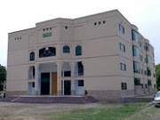
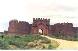


Culture

District Gujrat has been famous for the manufacture of low temperature pottery and ceramic goods. Apart from pottery, district Gujrat is also famous for the production of elegant ‘Hookas’ . Moreover, Gujrat is famous for its beautiful and artistic handicrafts, Flower pots, "Changairian" made by leaves of palm and date trees, cotton mates, "Dhusse" and woolen shawls are famous and very much popular throughout the country and abroad.

Industry


Gujrat is also known in the world for it's clay with which Gujratis produce quality pottery since ages. Apart from agriculture and clay the city is well known due to its furniture manufacturing skills . Gujratis have mastered the skills of conditioning the wood and producing world class furniture having immaculate finish. Over last few decades Gujrat has also attained a name in export of electric fans.


Gujrat has a unique status throughout the Punjab due to some of its manufacturing capabilities and productions. There are about 1,059 cottage level and small/medium/large scale industrial units operating in the district. Jalalpur is a large town of Gujrat , where several small and large textile industrial unit have been established.


There are many other industrial units and factories engaged in manufacturing of electrical goods (Fan), Electric Motors, Earthen Utensils, Shoes, Rubber Tyre Tube, Sanitary Ware ,Rice Cleaning Mills and Furniture. The high quality furniture made here have been used in National and Provincial Assemblies.


The story of emergence of electric fan manufacturing industry in Pakistan is one of those heroic efforts made by a few enterprising individuals who. Starting with nothing in early 1940s struggled against all odds and turned this concern into a most efficient industry in Pakistan .


This is an industry on which all Pakistanis can rightly be proud of. It does not owe its success to any foreign collaboration or any from the Government, but only to its own people whose constant research for maintaining good quality and devising new methods and techniques of production have now resulted in a product which we can rightfully claim as among the best in the world.


There are now over five hundred fan manufacturing units operating in Gujrat, Gujranwala , Lahore and a few other cities. Except for a few, the rest falls into the category of cottage industry. These small units from the real backbone of this industry. They provide employment to a large number of people and all put together account of more than 90 percent of the domestic market.
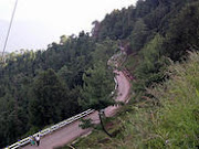


Communication


Gujrat, situated beside the grand trunk road and main Railway track is directly connected with the major cities like provincial and central metropolises of the country.


Road-Links:

The district has a total metalled road-length of 1019 Kilometres . The district is linked with Gujranwala , Jhelum , Mandi Bahauddin districts through metalled roads.


Rail-Links:

The main Peshawar - Karachi railway line passes through Gujrat district. The district is linked with Jhelum and Gujranwala districts through railway network.